The numbers and tools for the trek in one place: the full elevation profile, distance and days, the offline maps and GPX sources that actually contain Mardi, and the pre-trip and gear checklists. Altitudes vary slightly between GPS sources, so treat them as close approximations.
The standard route climbs from the Kande trailhead up a forested ridge to High Camp, then makes the dawn push to the Upper Viewpoint. The waypoint altitudes below are the most commonly cited figures, and they vary slightly between GPS sources. Note the two low approach variants, via Australian Camp or via Pothana, which is why those early altitudes differ.
| Waypoint | Altitude | Notes |
|---|---|---|
| Kande (trailhead, road-accessible) | ~1,770 m | Where the trek starts |
| Australian Camp (Thulo Kharka) | ~2,060 m | One of two low approach variants |
| Pothana | ~1,890 m | Alternative low approach |
| Forest Camp (Kokar) | ~2,550 m | First night for many |
| Low Camp | ~2,985 m | Tree line opening up |
| Badal Danda (Middle Camp) | ~3,210 m | Ridge views begin |
| High Camp | 3,580 m | Base for the dawn push |
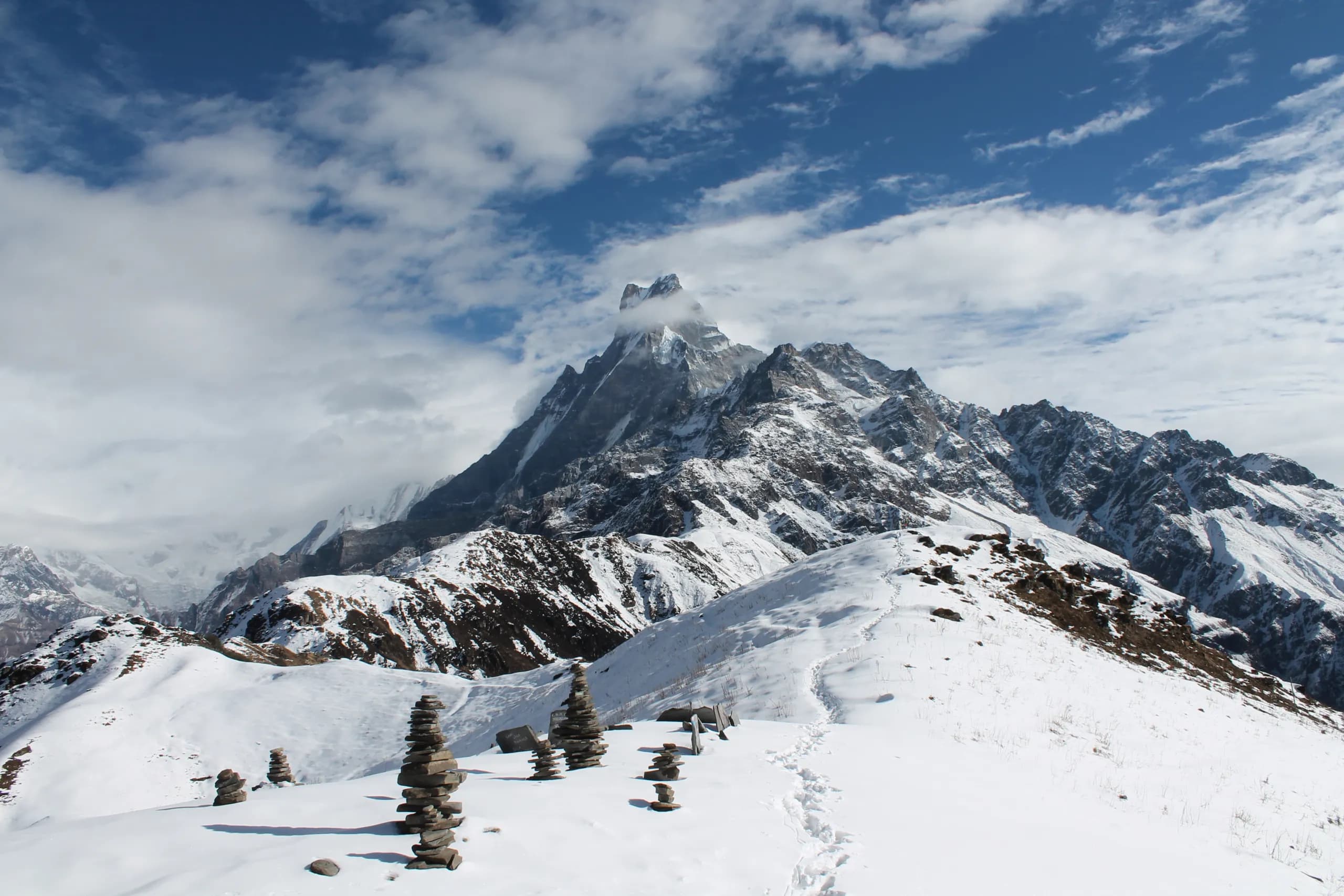
| Upper Viewpoint (turnaround) | 4,200 m | Usual standard turnaround |
| True Base Camp (longer trips) | 4,500 m | Not on every itinerary |
Important distinction: the Upper Viewpoint at 4,200 metres is the usual turnaround for the standard trek, while the true Base Camp at 4,500 metres is higher and not on every itinerary. For how these days link together, see the trek itinerary and the base camp page.
Total distance depends on how you measure it, so treat it as a range rather than a single figure. It runs from roughly 27 kilometres to 45 kilometres depending on whether you go round trip from Kande or point to point, and where you turn around. AllTrails puts the full route near 40.5 kilometres.
Varies with round trip versus point to point and the turnaround. AllTrails full route is ~40.5 km, with ~3,180 m cumulative gain over the route including descents.
The classic trek is about 5 days. Fit trekkers do 3 to 4, a relaxed pace takes 6 to 7. It depends on fitness and your turnaround point.
High Camp to the Upper Viewpoint is about 3 to 4 hours up for ~620 m of gain, then you descend. Daily legs lower down run 4 to 6 hours.
Signal drops higher on the trail, so download your maps in Pokhara before you start. These are the sources that actually contain the Mardi route. AllTrails and curated apps have cleaner data, while community tracks vary in quality, so carry a backup rather than trusting one app.
Full trek plus segment-by-segment trails with maps, distance, elevation, and reviews. GPX export needs paid AllTrails+. AllTrails rates the route hard.
Search Mardi Himal for routes and tours. Offline maps require buying the region first, so set it up before you lose signal.
Search Mardi Himal for community-uploaded GPX tracks, free to download with an account. Track quality varies, so cross-check before relying on one.
OpenStreetMap-based and free. Download the Nepal or Annapurna region for offline use. The Mardi trail is well mapped, though teahouse data can lag.
The standard route climbs from Kande at about 1,770 metres through Forest Camp (~2,550 m), Low Camp (~2,985 m), and Badal Danda (~3,210 m) to High Camp at 3,580 metres, then up to the Upper Viewpoint at 4,200 metres, which is the usual turnaround. The true Base Camp at 4,500 metres is only on longer itineraries. These altitudes vary slightly between GPS sources.
Total distance varies with the route, from roughly 27 to 45 kilometres depending on whether it is round trip from Kande or point to point, and where you turn around. AllTrails puts the full route near 40.5 kilometres. The classic trek runs about 5 days, with fit trekkers doing 3 to 4 and a relaxed pace taking 6 to 7.
AllTrails has a curated Mardi map (GPX export needs AllTrails+), Komoot and Wikiloc have route and user tracks you search by name, and Organic Maps or Maps.me give free OpenStreetMap offline maps when you download the Nepal or Annapurna region. Download whatever you choose in Pokhara before you start, because signal drops higher up.
The Upper Viewpoint at about 4,200 metres is the usual turnaround for the standard trek. The true Mardi Himal Base Camp at about 4,500 metres is higher and is not part of every itinerary, so many trips that use the base camp name actually turn around at the 4,200 metre viewpoint. Check which your itinerary means.
Roughly 5 to 6 hours from Kande to Forest Camp, then 4 to 6 hours from Forest Camp up toward Low and High Camp. The dawn push from High Camp to the Upper Viewpoint is about 3 to 4 hours up for around 620 metres of gain, then you descend. Continuing to the true Base Camp adds about 2 to 3 hours of uphill.
For free offline use, Organic Maps or Maps.me cover the Mardi trail well from OpenStreetMap data, so download the Nepal or Annapurna region in Pokhara. If you want a curated trail with elevation and reviews, AllTrails is the most concrete, though GPX export is paid. Carry a backup so you are not relying on one app.
We run small-group trips from Pokhara every Saturday from September to May. We also run private trips any day. A $50 deposit holds your place. Pay the rest on arrival in cash or by card.