Mardi Himal is a balcony hung off the side of Machhapuchhre, looking out at one of the densest clusters of high peaks in Nepal. This is the orientation page: which mountains stand nearest, what fills the skyline from each viewpoint, and where to stand at dawn.
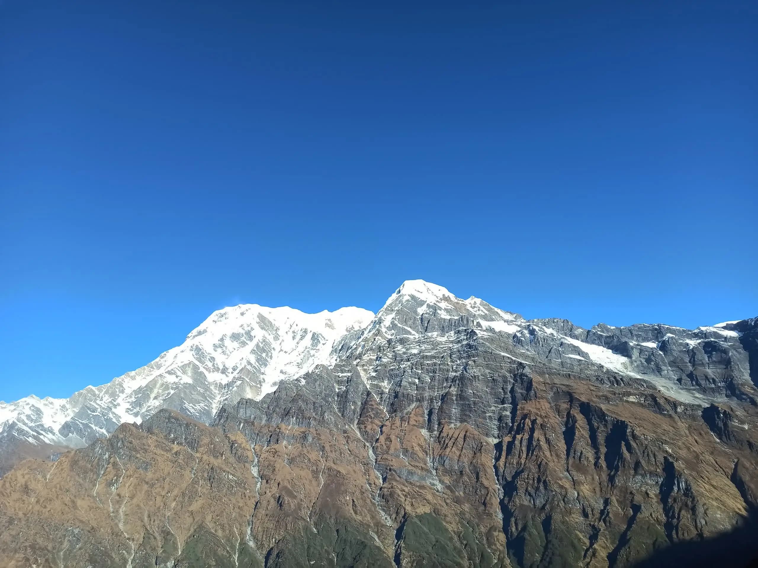
Mardi Himal does not stand alone. It is the ridge running off the south and south-west slopes of Machhapuchhre, the Fishtail, whose 6,993 m summit sits only about 2.5 to 3 km to the north-east. The two are joined by a col at roughly 5,200 m, so close that from the upper trail the Fishtail reads as a single sweep of rock and ice almost overhead rather than a separate mountain across a valley. That pairing is the defining fact of the route, and we unpack it in detail on our Machhapuchhre relationship page.
To the west, above the Modi Khola, stand the next two nearest giants. Annapurna South rises to 7,219 m and dominates the western horizon, with Hiunchuli at 6,441 m set just below and beside it. These three, Machhapuchhre, Annapurna South and Hiunchuli, are the peaks Mardi is physically wired to: they are confirmed by Wikipedia and named in every serious account of the trek. Behind them, set back from the foreground, is Annapurna I Main at 8,091 m, the tenth highest mountain on Earth and the high point of the whole massif. Exactly where Mardi sits on this connected chain is the subject of our position in the Annapurna massif page.
Eight peaks recur across the panorama. The first four are the close wall you feel the size of; the rest are named by multiple trip reports and operators, ranged across the skyline or on the far horizon. We list a peak here only when at least two independent sources name it from the Mardi viewpoints, and we flag where heights differ between sources.
The Fishtail, the nearest peak, 2.5 to 3 km north-east and joined to Mardi by a col around 5,200 m. Mardi is the ridge running off its south and south-west slopes. Officially unclimbed.
Dominates the western skyline above the Modi Khola. First climbed 15 October 1964 by the Kyoto University Alpine Club.
Stands just below and beside Annapurna South to the west. First climbed in October 1971 by an American expedition.
The tenth highest mountain on Earth and the high point of the massif, set back behind the closer peaks and seen on clear days from the upper viewpoint.
The Fluted Peak, a Sanctuary trekking peak west of the foreground, named in several upper-viewpoint trip reports.
Tent Peak, inside the Annapurna Sanctuary. Operators often round it to 5,695 m. Listed by multiple Mardi viewpoint accounts.
The eastern shoulder of the Annapurna chain, sitting behind Machhapuchhre as the skyline turns north-east. Named by several reports.
The seventh highest mountain in the world, far to the west beyond the Kali Gandaki. Visible only on the clearest mornings.
From the upper viewpoint around 4,200 m the skyline opens to nearly 360 degrees. Working from the close peaks outward, the consistently named summits, those reported by at least two independent operators or trip reports, are Machhapuchhre (6,993 m), Annapurna South (7,219 m), Hiunchuli (6,441 m) and Annapurna I (8,091 m), with the wider Annapurna chain including Annapurna II, III and IV ranged behind them. Several accounts also name Lamjung Himal on the eastern shoulder, and the Sanctuary trekking peaks Tent Peak (Tharpu Chuli, 5,663 m on Wikipedia, often rounded to 5,695 m by operators) and Singu Chuli (6,501 m) tucked into the western foreground.
On the clearest mornings the view stretches far beyond the local wall. Dhaulagiri (8,167 m), the seventh highest mountain in the world, appears to the west beyond the Kali Gandaki, and some accounts also name Manaslu (8,163 m) to the east. These are distant, weather-dependent horizon peaks rather than the close amphitheatre overhead, so treat them as a clear-day reward. One peak you will see named on a few sources but not others is Baraha Shikhar, Mount Fang (7,647 m), beside Annapurna I: we flag it as a single-source claim and leave it off the confirmed list. The deeper rock-and-ice story of how all this was thrust up is on our geography and geology page, the early climbing record on our first ascent history page, and the meaning behind the names on our name and meaning page.
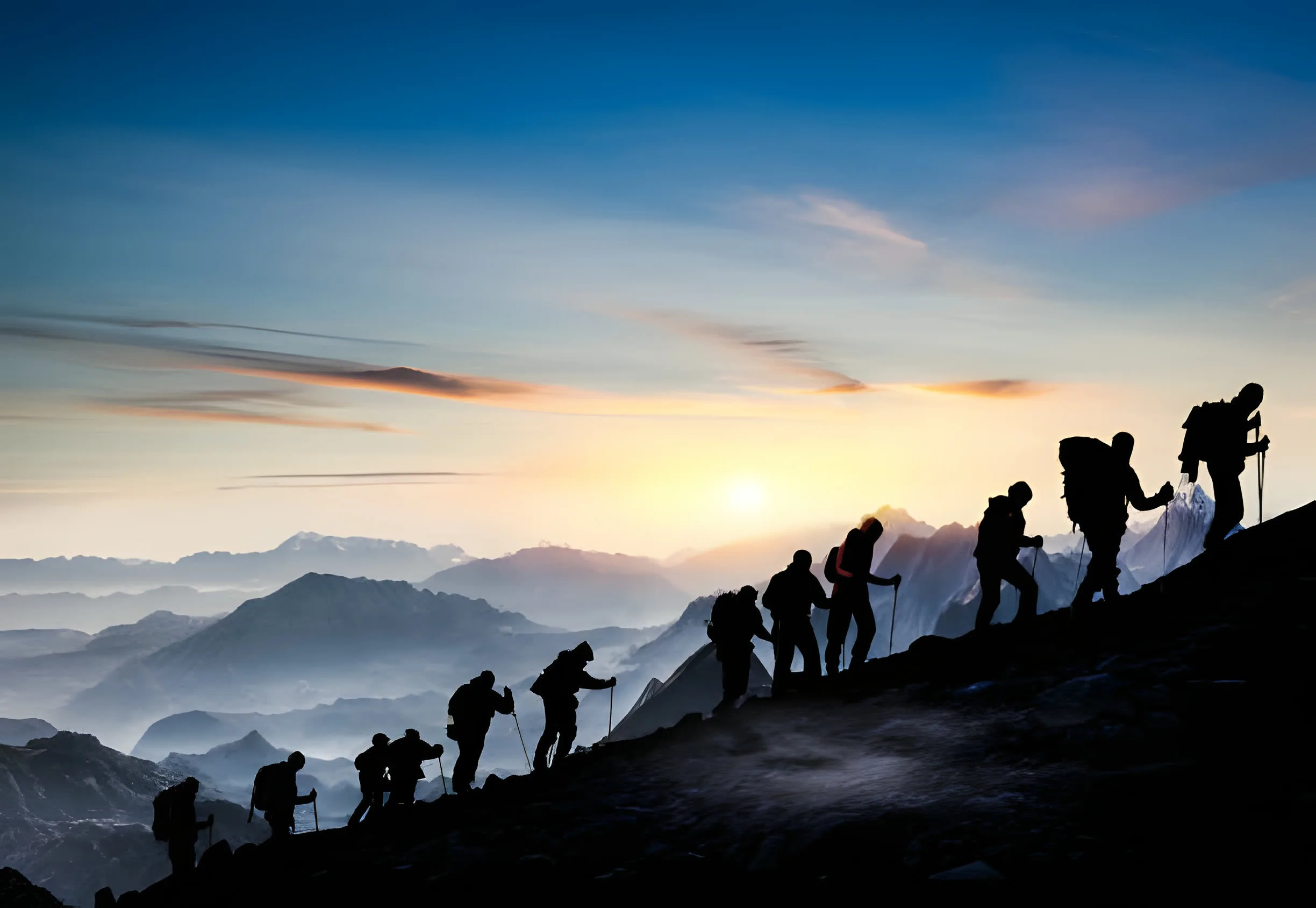
There are three places to take the view in. High Camp, around 3,580 m, is where most trekkers sleep, and it already gives a wide, open-sky panorama with Machhapuchhre filling the head of the valley. The upper viewpoint at around 4,200 m is the one most people rate highest: a near 360-degree skyline with the Fishtail overhead and the Annapurna South group across the west, reachable from High Camp in time for sunrise. Base camp at around 4,500 m is the highest point of the walk, pushing a little further under Machhapuchhre, though the panorama itself does not change dramatically above the upper viewpoint. The stage-by-stage walking route is on our Mardi Himal trek guide, with the top of the route detailed on our base camp page.
Timing matters as much as place. Trekkers leave High Camp before dawn to reach the upper viewpoint for sunrise, when the first light strikes the snow and turns the peaks gold. Machhapuchhre stands to the north-east, so the sun comes up roughly behind and to the right of the Fishtail and lights the western wall, Annapurna South and Hiunchuli, first. The cold, settled air just after dawn is also when the distant peaks, Dhaulagiri above all, are most likely to be clear before the cloud builds through the morning. For framing the shot, our photography page has the angles and the light.
The same massif gives three very different skylines depending on where you stand. Mardi reads it from a high ridge directly under Machhapuchhre, so the Fishtail looms larger here than on almost any other accessible trail, with Annapurna South and Hiunchuli across the west. Annapurna Base Camp walks into the glacial heart of the range and stands at the very foot of the 8,000 m wall, a closer but more enclosed amphitheatre ringed by peaks on every side. Poon Hill is lower and gentler, famous for a wide sunrise over Dhaulagiri and Annapurna seen from a softer distance rather than from beneath them. We set the two head to head on our ABC vs Mardi and our Poon Hill vs Mardi pages.
Machhapuchhre, the Fishtail, at 6,993 m. Its summit lies only about 2.5 to 3 km north-east of Mardi Himal, and the two are joined by a col at roughly 5,200 m. Mardi Himal is in fact the ridge that runs off Machhapuchhre's south and south-west slopes, which is why the trail looks almost straight up at the Fishtail rather than across a valley at it.
From High Camp, the upper viewpoint around 4,200 m and base camp around 4,500 m, trip reports and operators consistently name Machhapuchhre (6,993 m), Annapurna South (7,219 m), Hiunchuli (6,441 m), Annapurna I (8,091 m), and the wider Annapurna chain including Annapurna II, III and IV. Lamjung Himal, Tent Peak (Tharpu Chuli) and Singu Chuli appear in several accounts. On the clearest days Dhaulagiri to the west, and sometimes Manaslu to the east, come into view in the distance. We only list peaks named by at least two independent sources, and flag single-source claims.
On a clear morning, yes, but in the distance rather than close up. Several operators and trip reports name Dhaulagiri (8,167 m) far to the west beyond the Kali Gandaki, and some also name Manaslu (8,163 m) to the east. These are weather-dependent, distant horizon peaks, not the close wall of rock and ice that Machhapuchhre and Annapurna South form overhead. Treat them as a clear-day bonus rather than a guarantee.
Annapurna I Main, at 8,091 m, is set behind the closer peaks rather than in the foreground, so it is not the dominant sight from the trail the way Machhapuchhre and Annapurna South are. From the upper viewpoint around 4,200 m on a clear day it does come into view as part of the wider massif lining up behind the nearer summits. The eight-thousander you feel the size of, though, is the wall directly above you, not Annapurna I behind it.
Most trekkers rate the upper viewpoint at around 4,200 m as the best balance: it opens onto a near 360-degree skyline with Machhapuchhre overhead and the Annapurna South group filling the west, and it is reachable for sunrise from High Camp. High Camp around 3,580 m already gives a wide view and is where most people sleep before the dawn walk. Base camp around 4,500 m is the highest point, pushing further under the Fishtail, but the panorama does not change dramatically above the upper viewpoint.
Trekkers leave High Camp before dawn to reach the upper viewpoint for sunrise, when the first light strikes the snow and turns the peaks gold. Machhapuchhre stands to the north-east, so the sun rises roughly behind and to the right of the Fishtail and lights the western wall of Annapurna South and Hiunchuli first. The cold, clear air just after dawn is also when distant peaks like Dhaulagiri are most likely to be visible before cloud builds.
Mardi reads the massif from a high ridge directly under Machhapuchhre, so the Fishtail looms larger here than on almost any other accessible trail. Annapurna Base Camp walks into the glacial heart of the range and stands at the foot of the 8,000 m wall, a closer but more enclosed amphitheatre. Poon Hill is lower and gentler, famous for a wide sunrise over Dhaulagiri and Annapurna seen from a softer distance. We compare them side by side on our ABC vs Mardi and Poon Hill vs Mardi pages.
We run small-group trips from Pokhara every Saturday from September to May. We also run private trips any day. A $50 deposit holds your place. Pay the rest on arrival in cash or by card.