Spring season open · Mar 15 – Jun 25 places left · Classic 7d · May 03Rhododendron bloom reported at Forest Camp
Trail status: Open
Mardi Himal ridge, Annapurna, Nepal
Himalaya · Annapurna Himal · Gandaki Province

Mardi Himal

A 5,587 m peak on the southern wall of the Annapurna massif, and the quietest major trek in the range. This is the complete field guide to the mountain: its geography, its people, its climate, its climbing history, and how to walk its ridge with local guides who have lived beneath it for generations.

Elevation
5,587m
First ascent
1961
Range
Annapurna
Coordinates
28°31'N
83°56'E
Trek opened
2012

Nepal's Hidden Ridge

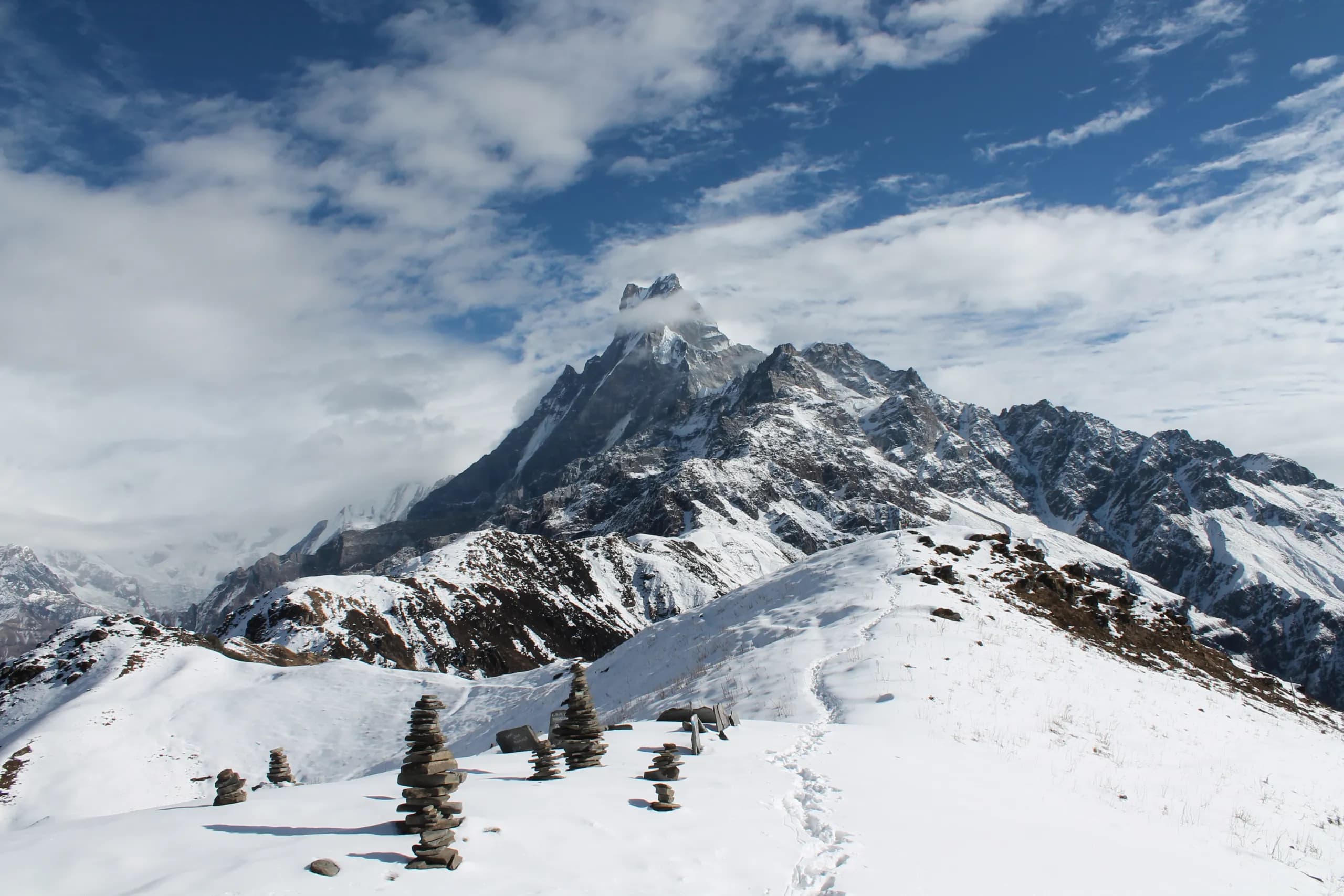
Mardi Himal is a 5,587-metre peak that extends like a southern finger from the Annapurna massif, rising between its two most famous neighbours, Machapuchare (the sacred “Fishtail,” 6,993 m) and Annapurna South(7,219 m). It takes its name from the Mardi Khola, the river that drains its southern flank and eventually joins the Seti, then the Trishuli, then the Ganges.

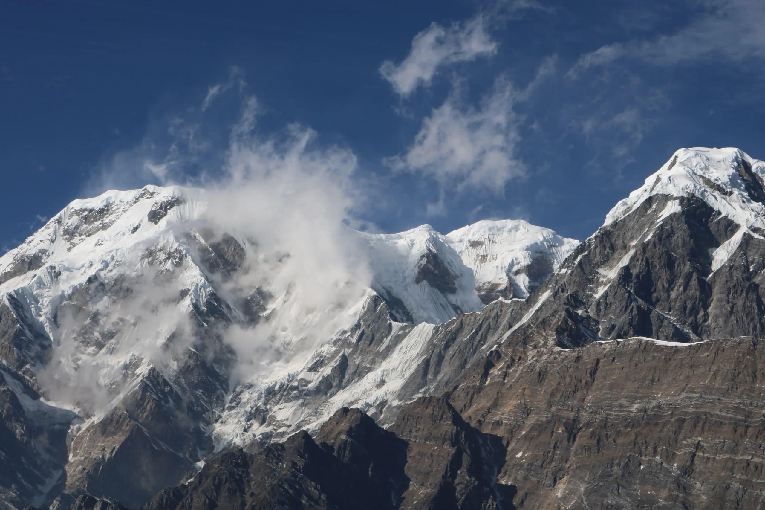
From a geological perspective, Mardi Himal shares the same ancient origins as the rest of the Annapurna range. It is formed from some of the oldest rocks in the Himalayas, shaped over millions of years by the ongoing collision between the Indian and Asian tectonic plates. Even today, the mountains are still slowly rising.

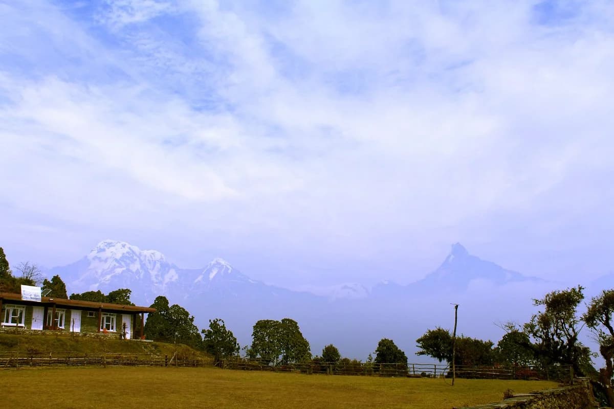
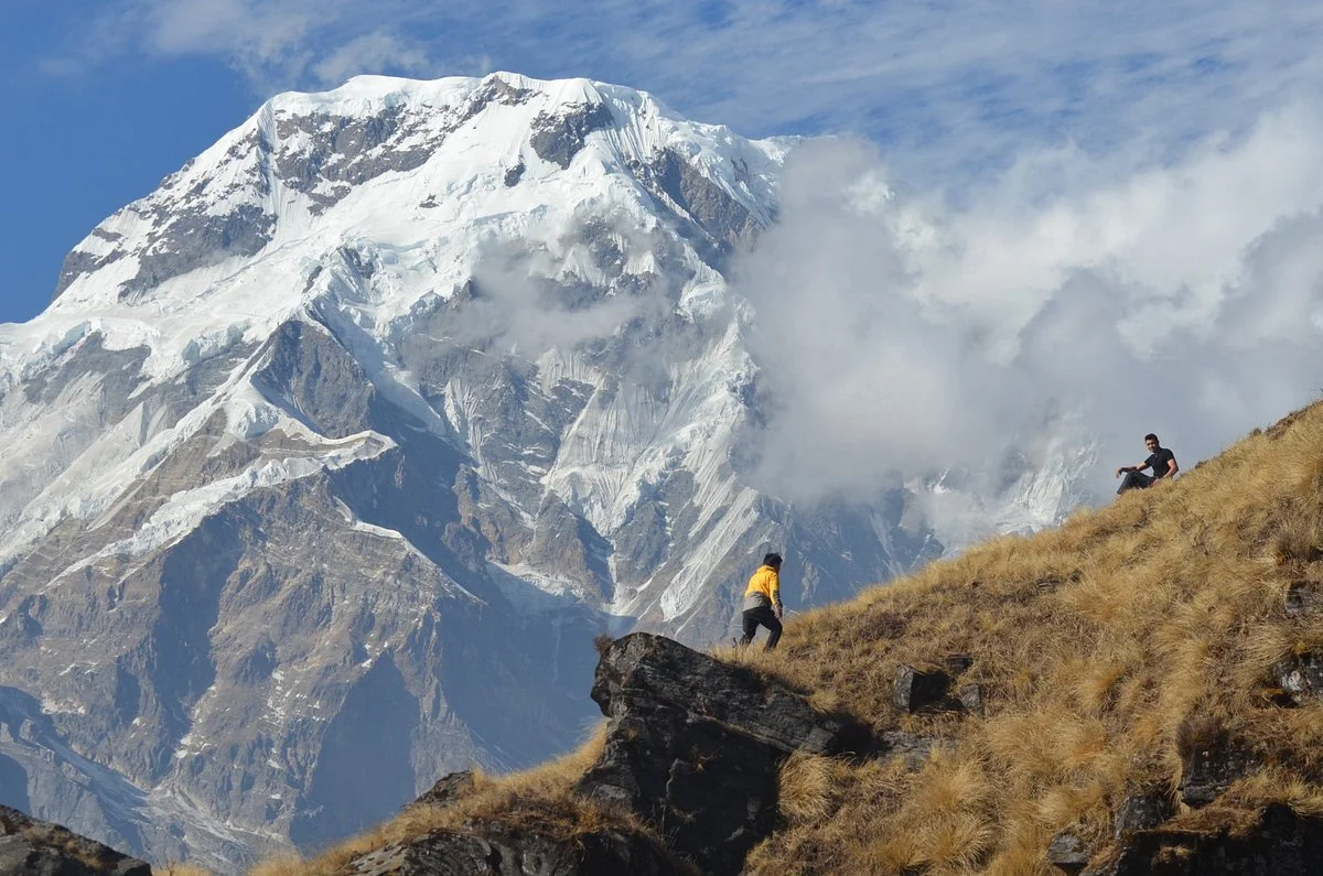
What truly sets Mardi Himal apart, however, is its striking ridge. A sharp, continuous line runs from the summit all the way down toward the foothills near Pokhara, about 40 kilometres to the south. This long, exposed ridge creates dramatic landscapes and offers some of the most unique and close-up mountain views you can experience in Nepal.

That ridge is why the trek exists. It offers a rare, direct line from lowland farmland at 820 m to the alpine zone at 4,500 m in four days of walking, passing through every climate belt of the central Himalaya on a single trail. The summit itself remains a climber's peak (first ascended 1961, open by permit), but the ridge up to High Camp is walkable without ropes or crampons.

The mountain was effectively unknown to trekkers until 2012, when the Annapurna Conservation Area opened the ridge as an official route. A decade later it remains one of the least-walked major trails in Nepal, roughly one trekker for every fifty on the neighbouring Annapurna Base Camp path.

Mardi, the spine.

Machhapuchhre ridge, neighbour to Mardi Himal
The sharp south ridge of the Annapurna wall, the “spine” the name points to.

Long before the name मर्दी हिमाल (Mardi Himal) was ever written in the neat curves of the Devanagari script, it was already being spoken softly among the hills. The word “Mardi”is believed to come from the languages of the Magar and Gurung communities, who have lived in the Annapurna foothills for generations. In their understanding, “Mardi” carries the meaning of a “spine” or “backbone.”

If you stand before the mountain and take a quiet moment to observe it, the meaning reveals itself naturally. A single, sharp ridge runs down from the summit like a backbone (strong, continuous, and unbroken), stretching toward the rivers, which feed the Seti Gandaki, then the Trishuli, and eventually the Ganges above Pokhara. It feels less like a coincidence and more like a name that was gently discovered rather than invented.

The second part, “Himal,” is more familiar in Nepali. It simply means a snow-covered mountain, derived from the word hima, meaning snow, the same root found in the great Himalayaitself. Together, the name “Mardi Himal” becomes more than just a label; it becomes a reflection of both the land and the people who have understood it for centuries.

The ridge and the slopes beneath it are the ancestral highlands of the Gurung (who call themselves Tamu) and Magar hill peoples (Tibeto-Burman communities who have grazed these pastures for generations, long before the trail was ever mapped).

Read about the people & culture

5,587 m: every climate belt stacked on one ridge.

Mardi Himal rises from the 820-metre valley floor at Pokhara to a 5,587-metre summit in roughly 40 kilometres of horizontal distance. Along that line you climb through every vegetation zone in the central Himalaya, from subtropical banana terraces to glaciated rock.

Nival
5,000 m +
Glaciated summit pyramid
Alpine
3,500 – 4,500 m
Shrubland, meadow, moss
Subalpine
2,500 – 3,500 m
Bamboo, fir, hemlock
Temperate
1,500 – 2,500 m
Oak, rhododendron forest
Subtropical
820 – 1,500 m
Terraced farmland, banana
Annapurna South seen from the Mardi Himal ridge
Annapurna South from the Mardi ridge

Altitude table

Highest → lowest
SummitNMA trekking peak
5,587 m
Climber's Base CampPeak-climbing only
4,500 m
Upper ViewpointTrekker's high point
4,200 m
High CampFinal overnight
3,580 m
Badal Danda“Cloud Ridge”
3,210 m
Low CampRidge opens up
2,985 m
Forest CampRhododendron belt
2,550 m
Kande (trailhead)Road access
1,770 m
PokharaNearest city
820 m

Two perfect seasons. Two harder ones.

Weather on Mardi Himal is governed by the South Asian monsoon. Spring and autumn are when the mountain is at its most readable; the rest of the year, the ridge above 3,500 m behaves like a different mountain entirely.

§ Spring
Best

Spring

March–May
Day5 – 15 °C day
Night−5 to 5 °C night at 4,500 m

Mild temperatures, steady weather, and the rhododendron forests below 3,300 m in full bloom. This is the classic postcard window for Mardi Himal.

  • Rhododendron bloom
  • Occasional light showers
  • Busy trail, book ahead
§ Autumn
Best

Autumn

September–November
Day10 – 16 °C day
Night−5 °C or lower at night

The clearest skies of the year. After the monsoon, the air loses its haze. Most mornings you can see Dhaulagiri from the Upper Viewpoint.

  • Crispest mountain views
  • Peak trekking season
  • Cold, dry nights
§ Winter
Possible

Winter

December–February
Day0 – 10 °C day
Night−10 to −15 °C night above 3,500 m

Quiet trails and clean snow above 3,500 m. Some high-camp lodges close. Microspikes or crampons help. For experienced trekkers only.

  • Snow above 3,500 m
  • Some lodges closed
  • Serene & empty
§ Monsoon
Avoid

Monsoon

June–August
Day15 – 25 °C day
Night5 – 15 °C at higher altitudes

Warm and wet. Heavy rain, muddy trails, leeches in the forest, clouds at every viewpoint, and a real risk of landslides on the lower sections. Not recommended.

  • Heavy rainfall
  • Landslide risk
  • Limited visibility

A climbing peak that became a trekking route: six chapters.

Mardi Himal was climbed before it was walked. Until 2012 the summit was better known than the ridge below it. Here is the timeline.

1953Earliest survey

Swiss surveys of the Annapurna massif

The peak is first catalogued by André Roch's Swiss expedition to Annapurna South as a minor southern outlier. No attempt is made.

1961First ascent

Goodfellow expedition summits the peak

British climber Basil Goodfellow reaches the summit with a party of Nepalese sherpas, approaching via the north-east ridge from the Mardi glacier. The climb is lightly reported and the mountain returns to obscurity.

1986Conservation Area

ACAP is established

The Annapurna Conservation Area Project (the largest in Nepal at 7,629 km²) brings Mardi Himal under formal protection. The ridge remains closed to trekking permits.

2012Trail opens

The ridge is opened as a trekking route

ACAP and the local Gurung VDCs open the southern ridge between Kande and Siding as the first formally permitted Mardi Himal trek. Four teahouses are built in the first year.

2018Infrastructure

High Camp teahouse construction

A permanent stone teahouse is built at 4,500 m by families from Siding and Lwang, allowing overnight stays at the viewpoint and extending the trek from 5 days to the now-standard 7-day Classic route.

2024Status

~12,000 trekkers annually

Mardi Himal now sees roughly one-fiftieth the traffic of Annapurna Base Camp on the same mountain. ACAP has capped teahouse construction to preserve the trail's character.

One ridge, five days, 2,730 metres of ascent.

The standard trekking route climbs the southeast ridge of Mardi Himal from the roadhead at Kande (1,770 m) to the Upper Viewpoint at 4,200 m. Peak-climbing parties continue above to the 4,500 m climbers' base camp and the summit pyramid.

Mardi Himal route map (placeholder)
Placeholder map

Interactive trek map coming soon

Day 1
KandeForest Camp
1,770 → 2,550 m
+780 m
Day 2
Forest CampLow Camp
2,550 → 2,985 m
+435 m
Day 3
Low CampHigh Camp
2,985 → 3,580 m
+595 m
Day 4
High CampUpper Viewpoint
3,580 → 4,200 m
+620 m
Day 5
High CampSiding / Kande
3,580 → 1,660 m
−1,920 m
Trek permits

ACAP + TIMS required. Licensed guide mandatory for foreigners.

Peak climbing

An extra NMA trekking-peak permit is needed for the 5,587 m summit.

Highest trekking point

Upper Viewpoint · 4,200 m (14,764 ft)

What trekkers actually talk about.

Strip away the brochures and five things keep coming up in first-hand accounts of Mardi Himal. They are the reasons the mountain went from unknown to word-of-mouth favourite in a decade.

  1. 01

    The closest you can stand to Machhapuchhre

    Mardi Himal is the southwest shoulder of Machhapuchhre, the sacred Fishtail peak that has never been legally climbed. The Mardi ridge stands closer to it than any other point a trekker is allowed to reach, and that head-on view is the single image the mountain is known for.

    Mardi & Machhapuchhre
  2. 02

    A ridge walk above the clouds

    The classic Annapurna treks walk valleys. Mardi walks one long open ridge between the Mardi Khola and the Modi Khola, with cloud filling the valleys on either side of the trail. The stage at 3,210 m is called Badal Danda, which literally means cloud ridge.

    The route, stage by stage
  3. 03

    The quietest major trail in the Annapurnas

    The route opened to teahouse trekking only in 2012, decades after Poon Hill and Annapurna Base Camp, and it still carries a fraction of their foot traffic. Trekkers weighing the two routes consistently come back to the same word for Mardi: quiet.

    Mardi vs Annapurna Base Camp
  4. 04

    The summit morning from High Camp

    Ask people back from the trail for the best part and the answer repeats: the pre-dawn push from High Camp up the narrowing ridge to the viewpoint at 4,200 m, headtorches in the dark and the whole Annapurna wall turning orange at sunrise.

    What is at the top
  5. 05

    A Himalayan trek that fits inside a week

    The trailhead is a 90-minute drive from Pokhara and no domestic flight is involved at either end. The whole trek fits between two lakeside nights in four to seven days, which is how it became the short trek of choice in the region.

    Every version of the trek

How people answer it.

A mountain that famous gets responded to in different ways: walked, climbed, flown over, photographed. Each one has its own full guide on this site; this is the map of them.

The numbers, up front.

Difficulty, cost, season, the guide rule: the things everyone searches about Mardi Himal, answered in one place. Each links to the full guide.

Difficulty
ModerateNo ropes, no technical ground. Two big climbing days and altitude above 3,000 m are the work.Difficulty & map
Trek cost
From USD 2505-day group rate per person. 7-day from USD 380, 3-day heli express from USD 1,250.Full cost breakdown
Duration
3 – 7 daysFrom the heli-return express to the standard week. All versions reach the same viewpoint.Day-by-day itinerary
Best months
Oct – Nov · Mar – MayClearest skies in autumn, rhododendron bloom in spring. Winter is possible with snow above High Camp.Month by month
Guide rule
Guide mandatorySince April 2023 foreign trekkers cannot walk guideless in the Annapurna Conservation Area.Solo trekking rules
Highest points
4,200 m viewpointHigh Camp at 3,580 m is the highest sleeping point. True Base Camp at 4,500 m is a climbing-trip objective.Base camp explained
Permits
ACAP + TIMSBoth mandatory, both arranged for booked trekkers. The summit additionally needs an NMA permit.Permit details
Trailhead
KandeA 1.5-hour drive from Pokhara. The trek exits via Sidhing, a jeep ride back to the lakeside.How to reach

First climbed in 1961, or 1962?

Almost every source online says Mardi Himal was first summited in 1961 by Basil Goodfellow. But when you read the two original journal articles written by the men themselves, a different story appears. This is what they found; we'll let you decide.

01

In March 1953, Basil Goodfellow walked north from Pokhara with Frank Yates, reached 14,000 ft on a ridge west of Siklis, and photographed a 17,000-ft peak at the head of the Mardi Khola. He identified it on the map. He did not climb it.

02

On 23 April 1962 (Easter Monday), Lt. Col. J. O. M. Roberts reached the summit with Sherpas Angcherring and Tenzing Nindra via a 2,000-ft frozen-snow couloir. He filed the first-ascent report to the Alpine Journal that year.

03

So: is “1961 by Goodfellow” a conflation of a photograph and a summit, a different expedition the primary sources don't mention, or just a long misprint? We don't know. Read their words below.

The two ridges shown on the map as bounding the Mardi Khola meet in fact at a subsidiary peak of about 17,000 feet, from which the south-west ridge of Machhapuchhare develops.
B. R. GoodfellowFirst Western observer to photograph the peak, March 1953“North of Pokhara,” Himalayan Journal Vol. 18, 1954
This little peak, which sticks up nicely when seen from Pokhara airstrip, was climbed by a party consisting of the Sherpas Angcherring and Tenzing Nindra and myself on Easter Monday, April 23, 1962.
J. O. M. RobertsFirst recorded ascent of Mardi HimalAlpine Journal Vol. 67, 1962
We left a pair of striped pyjama trousers tied to a 6-foot pole on the summit. Mardi Himal (17,700 ft.) is a fine view point.
J. O. M. RobertsSummit moment, 23 April 1962Alpine Journal Vol. 67, 1962

Primary sources (external archives · opens in new tab): Himalayan Journal Vol. 18 (1954) · Alpine Journal Vol. 67 (1962), pp. 336–337.

Answers to the questions people actually ask.

The questions people search and ask on every booking call, answered plainly.

Where is Mardi Himal located?

Mardi Himal is a 5,587-metre peak in the Annapurna Himal range of north-central Nepal. It sits inside the Annapurna Conservation Area of Kaski District, about 40 km north of Pokhara, directly beneath Machhapuchhre.

How high is Mardi Himal?

The summit stands at 5,587 m (18,330 ft) above sea level. The highest point reached by most trekkers is the Upper Viewpoint at 4,200 m.

How high is Mardi Himal Base Camp?

Three different points get called base camp. High Camp at 3,580 m is the highest sleeping point on the trek. The Upper Viewpoint at 4,200 m is the spot most people mean, and the trek's high point. The true Mardi Himal Base Camp sits at 4,500 m and is normally reached only on climbing trips. Base camp explained

How difficult is the Mardi Himal trek?

Moderate. There is no technical climbing, no ropes, and no glacier on the trek. The work is two long climbing days of roughly a thousand metres each and the altitude above 3,000 m. Reasonably fit beginners manage it well on the 5 or 7-day pacing; the shorter versions suit trekkers with prior altitude experience. Difficulty, grades & route map

How long is the Mardi Himal trek?

Three to seven days depending on the version. The 5-day is the standard most people book, the 7-day adds acclimatisation margin, the 4-day walks the same route faster, and the 3-day express returns by helicopter. A peak-climbing expedition to the 5,587 m summit takes 12 to 16 days. Day-by-day itinerary

How much does the Mardi Himal trek cost?

Guided group rates start at USD 250 per person for the 5-day trek and USD 380 for the 7-day, including permits, guide, accommodation, and transfers. The 3-day helicopter-return express starts at USD 1,250. Independent budgets run lower but the guide, permits, food, and lodges still add up. Full cost breakdown

Do I need a guide, or can I trek solo?

A licensed guide is mandatory. Since 1 April 2023 Nepal does not permit foreign trekkers to walk guideless inside the Annapurna Conservation Area, where the whole Mardi route sits. You can still travel solo in the everyday sense, at your own pace with your own itinerary, but a guide walks with you. Solo trekking under the 2023 rule

When is the best time to go?

Autumn (September–November) has the most stable weather and the clearest mountain views, and spring (March–May) adds the rhododendron bloom. For summit attempts, pre-monsoon April–May is preferred. Best season, month by month

Can you trek Mardi Himal in December or January?

Yes. Winter brings the clearest skies of the year and an empty trail, with the trade-off of snow above High Camp and hard cold at night. Teahouses stay open. Microspikes and a serious sleeping bag make the difference; some winter weeks the final viewpoint push depends on snow conditions. Weather by season & altitude

Do I need a permit?

Yes. ACAP and TIMS are mandatory for the trek, and both are arranged for booked trekkers. Climbing the summit additionally requires an NMA trekking-peak climbing permit.

Is the Mardi Himal trek worth it?

If you want big Annapurna views without the crowds, yes. The trail opened to teahouse trekking only in 2012 and remains the quietest major route in the region, and the Upper Viewpoint puts you closer to Machhapuchhre than any other legal vantage point. Trekkers who want villages and culture en route may prefer Poon Hill or a combined route.

Can I combine Mardi Himal with Annapurna Base Camp or Poon Hill?

Yes, both are established combinations. Mardi plus ABC takes about 14 days and links the ridge with the Sanctuary. Mardi plus Poon Hill runs about 9 days with two sunrise viewpoints and the Gurung village of Ghandruk. A quieter 11-day pairing links Mardi with Khopra Danda. All treks & combined routes

Who first climbed Mardi Himal?

Basil Goodfellow is credited as the first to reach the summit in 1961, on a British expedition led by Jimmy Roberts. Roberts' own account in the Alpine Journal dates his ascent to Easter Monday 1962; the sources are quoted in full in the section above.

Is Mardi Himal sacred?

There is no formal ban on climbing the mountain. That is unlike its neighbour Machhapuchhre, which is sacred and closed to climbers. Local Gurung and Magar communities still see the ridge as part of their home highlands.

What does the name "Mardi" mean?

Mardi is locally understood as spine or backbone, after the shape of the mountain’s long, single south ridge. Himal is the Nepali word for a snow mountain.

Read the mountain, then come walk it.

We run small-group trips from Pokhara every Saturday from September to May. We also run private trips any day. A $50 deposit holds your place. Pay the rest on arrival in cash or by card.