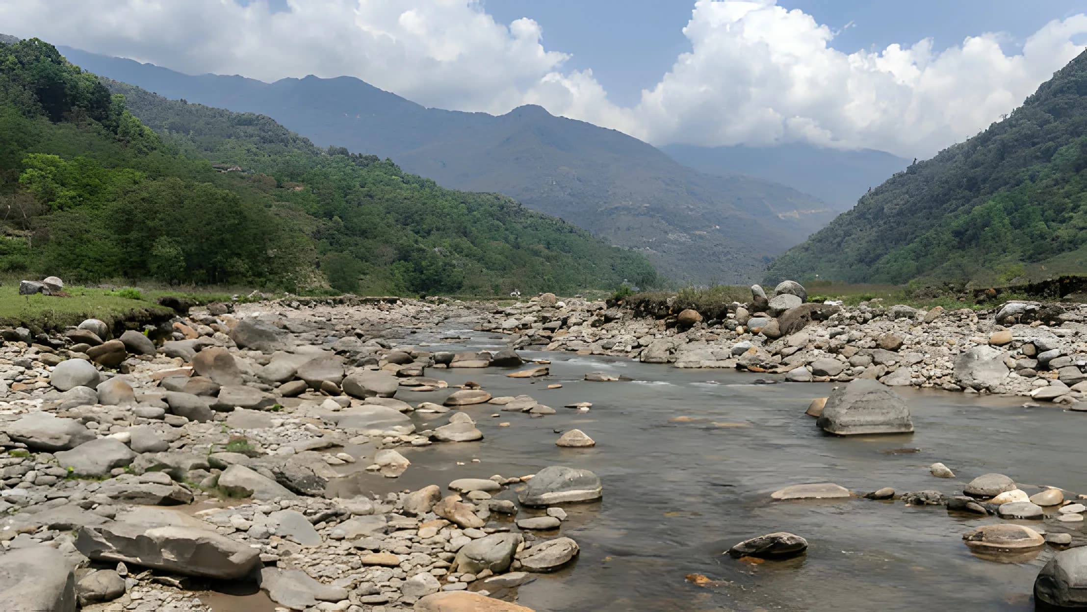
The glaciers on Mardi Himal feed the Mardi Khola, which runs down to the milky-white Seti River and its hidden gorges under Pokhara. The valley they cut was built by a single medieval landslide, and the ice that feeds them is now retreating.
The Mardi Khola is a snow and glacier-fed stream that rises on Mardi Himal itself. It flows south through the Lwang-Ghalel area of Kaski District and joins the Seti Gandaki near Pokhara, where it is named among the Seti's tributaries. Its glacial source on Mardi Himal and its status as a Seti tributary are solid; the precise figures sometimes quoted, a source around 5,127 m and a length of around 25 km, come only from operator blogs, so we treat them as approximate rather than confirmed.
The same river the trail follows in its lower stages gives the mountain part of its identity: the name Mardi Himal is tied to the Mardi Khola. The full story of the name is on our name and meaning page.
The Seti Gandaki rises from the base of the Annapurna massif, specifically the Sabche Cirque glacial plateau, fed by the snowfields and glaciers of Machhapuchhre and Annapurna. Its name means white: the river carries so much suspended glacial silt that the water runs a milky white. Over its roughly 113 km it gathers the Mardi Khola and other tributaries, the largest being the Madi, before joining the Trishuli near Devghat within the Gandaki system.
Around Pokhara the Seti does something unusual. The whole river goes underground for about 3 km, then cuts deep, narrow gorges through the city, with channels as little as a couple of metres wide and depths reaching tens of metres. The 3 km underground reach is the confirmed figure; the headline gorge-depth numbers on tourism sites are unverified. The river is not only scenery: the Seti flash flood of 5 May 2012 killed around 72 people. There is more on the city in our Pokhara travel guide.
Pokhara sits on the wreckage of a collapsed peak. Around 1190 to 1255 CE, the western flank of Annapurna IV gave way in a mega-landslide. Roughly 23 cubic kilometres of rock fell nearly 3,000 vertical metres into the Sabche Cirque, shearing about 500 m off Annapurna IV, which had been an eight-thousander and now stands at 7,525 m.
The debris dammed the Seti gorge and built a sediment fan about 200 m deep, the ground Pokhara is built on today. It also dammed side streams, creating Phewa, Rupa, Begnas, and other lakes, while one or several megafloods carried the conglomerate down the valley. The event was reconstructed in a peer-reviewed study, "Medieval Demise of a Himalayan Giant Summit Induced by Mega-landslide," by Lavé and colleagues, published in Nature.
The glaciers that feed all of this are shrinking. In the wider Annapurna region the Gangapurna glacier retreated by up to 24.4 metres a year between 1979 and 2016, and the Annapurna III glacier by 7.54 metres a year from 1950 to 2016. Across Nepal, glaciers lost about a quarter of their area between 1980 and 2010, and Himalaya-wide surface thinning accelerated from about 23 cm a year (1975 to 2000) to about 43 cm a year (2000 to 2016).
The warming behind this is measurable: Nepal's mean temperature rose about 0.027°C a year, and about 0.03°C a year above 2,000 m, from 1975 to 2015. NASA has studied the 2012 Seti flash flood and its links to high-mountain rock and ice collapse, a reminder that the same forces that built the valley still shape the rivers off Mardi Himal today.
The Mardi Khola is a snow and glacier-fed stream that rises on Mardi Himal. It flows south through the Lwang-Ghalel area of Kaski District before joining the Seti Gandaki near Pokhara, where it is listed among the Seti's tributaries. Some operator pages give a source elevation of around 5,127 m and a length of around 25 km, but these figures appear only on blogs and are unverified, so we treat them as approximate.
Seti means white in Nepali. The river carries a heavy load of suspended glacial silt, the fine rock flour ground out by the glaciers at its source, which gives the water its milky-white colour. The Seti rises from the base of the Annapurna massif, specifically the Sabche Cirque, fed by the snowfields and glaciers of Machhapuchhre and Annapurna.
Yes. Near Pokhara the entire Seti disappears underground for about 3 km, then cuts deep, narrow gorges through the city, with channels as little as a couple of metres wide. This underground reach of around 3 km is confirmed by Wikipedia; the various gorge-depth figures quoted on tourism sites are unverified.
A mega-landslide. Around 1190 to 1255 CE, the western flank of Annapurna IV collapsed, sending roughly 23 cubic kilometres of rock nearly 3,000 vertical metres down into the Sabche Cirque. The debris dammed the Seti gorge and built the deep sediment fan that Pokhara now sits on, and dammed side streams to create lakes such as Phewa, Rupa, and Begnas. The finding was published in Nature by Lavé and colleagues.
Yes. The Gangapurna glacier in the wider Annapurna region retreated by up to 24.4 metres a year between 1979 and 2016, and the Annapurna III glacier by 7.54 metres a year from 1950 to 2016. Across Nepal, glaciers lost about a quarter of their area between 1980 and 2010, and Himalayan ice loss accelerated from about 23 cm a year (1975 to 2000) to about 43 cm a year (2000 to 2016).
The Seti flash flood of 5 May 2012 killed around 72 people. NASA studied the event and its links to high-mountain rock and ice collapse feeding into the Seti system. It is a modern echo of the catastrophic megafloods that, centuries earlier, carried the medieval landslide debris down the same valley.
We run small-group trips from Pokhara every Saturday from September to May. We also run private trips any day. A $50 deposit holds your place. Pay the rest on arrival in cash or by card.