Mardi Himal is not a peak that stands alone. It is the southernmost ridge of the Annapurna massif, a 55 km wall of ice that holds one of the world's eight-thousanders. From its high viewpoint the trail looks straight up at Machhapuchhre, with Annapurna South and Hiunchuli filling the western sky.
The Annapurna massif is a single great range in north-central Nepal, running about 55 km between two of the deepest river valleys in the world: the Kali Gandaki gorge in the west and the Marshyangdi River curling around the north and east. The Pokhara valley lies along its southern edge. Within that span the massif carries an astonishing concentration of high ground: one peak over 8,000 m, thirteen peaks over 7,000 m, and sixteen more over 6,000 m, according to Wikipedia.
The crown of the range is Annapurna I Main at 8,091 m, the tenth highest mountain on Earth. It was the first eight-thousander ever climbed, by Maurice Herzog and Louis Lachenal of the 1950 French expedition, who reached the summit on 3 June 1950 without bottled oxygen and barely survived the frostbitten descent. Mardi Himal sits far below that summit, around 5,587 m, but it shares the same family of ridges. The names that recur on this skyline, Annapurna I, II, III and IV, Gangapurna, Annapurna South, all belong to the same connected chain, and Mardi Himal hangs off its southern end like a balcony turned toward the lowlands. For the deeper rock-and-ice story of how this range was thrust up and carved out, see our geography and geology page.
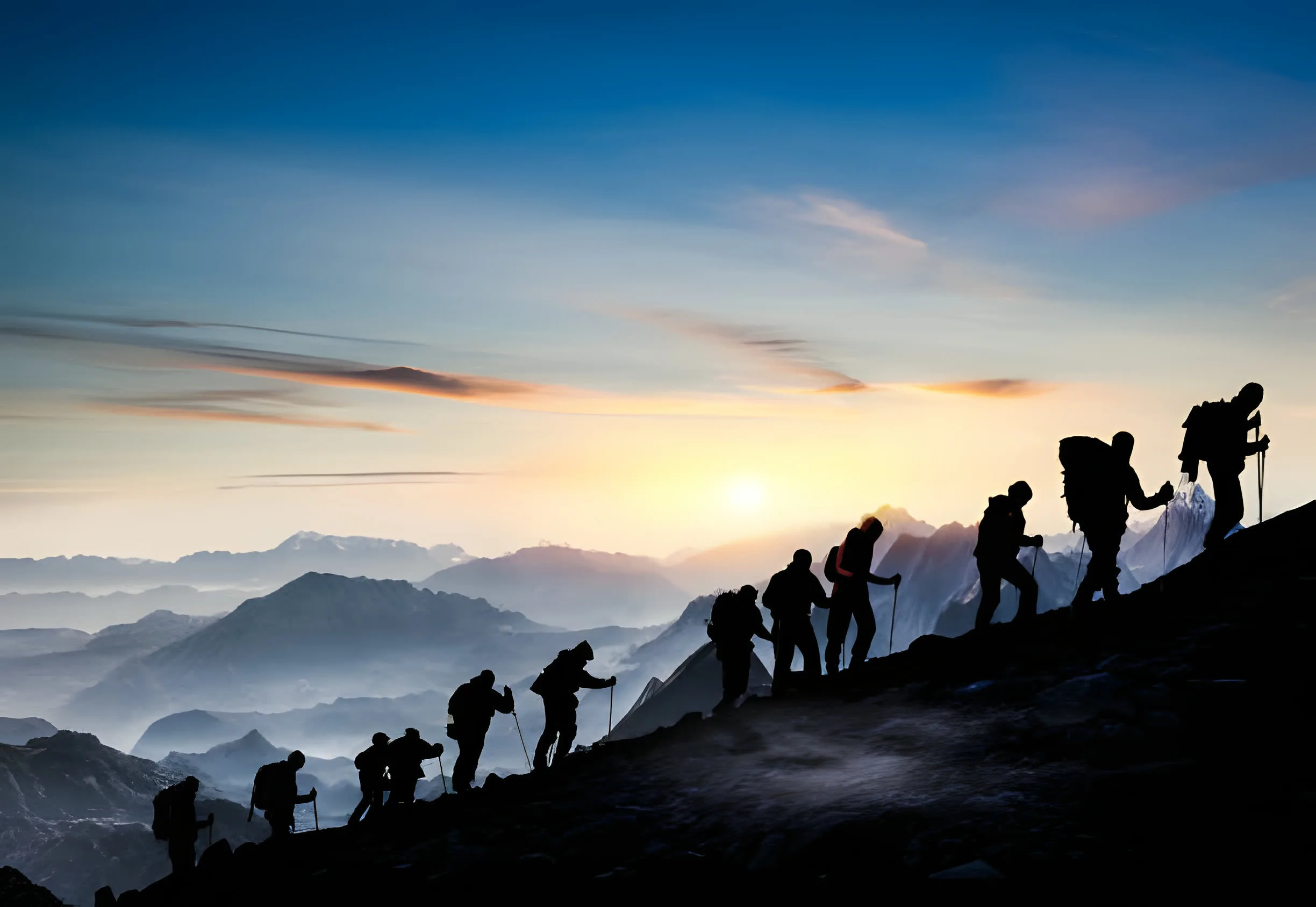
Mardi Himal is the southernmost outlier ridge of the massif. It pushes south from the main wall, directly below Machhapuchhre, on a spur that reaches down toward Pokhara. That position is the whole point of the trek: instead of approaching the range up a deep gorge, the Mardi trail climbs the leading edge of the mountains, so the high viewpoint sits almost beneath the Fishtail rather than across a valley from it.
The relationship to Machhapuchhre defines the peak. Mardi Himal is separated from the Fishtail by a col at roughly 5,200 m, and the two summits lie only about 2.5 to 3 km apart, with Machhapuchhre to the north-east. We unpack that pairing in detail on our Machhapuchhre relationship page, and the early climbing record on our first ascent history page. The walking route itself, stage by stage, is on our Mardi Himal trek guide.
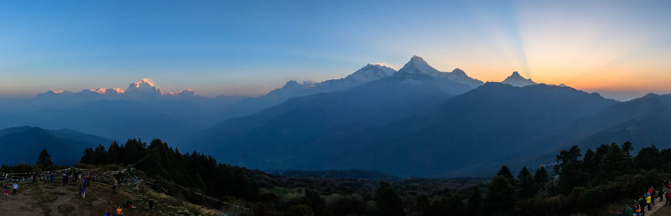
From the upper Mardi viewpoint the skyline is tight and close. Three named peaks dominate the view, and on a clear day the wider wall of the massif lines up behind them, with Annapurna I itself just out of the foreground. Because the trail climbs the leading ridge rather than a side valley, these summits feel unusually near: the rock and ice read as a single sweep from the col below Machhapuchhre across to the Annapurna South group, with little foreground to soften the scale.
The Fishtail, 2.5 to 3 km north-east of Mardi Himal, separated by a col around 5,200 m. Officially unclimbed.
First climbed 15 October 1964 by the Kyoto University Alpine Club. A dominant peak on the western skyline.
First climbed October 1971 by an American expedition. It stands beside Annapurna South above the Modi Khola.
For the full viewpoint panorama, which peaks you see from each camp, and whether Dhaulagiri and Manaslu are really visible, see our guide to the mountains near Mardi Himal.
The whole massif sits inside the Annapurna Conservation Area, Nepal's largest protected area at 7,629 sq km, about 5.8% of the country. It climbs from around 790 m up to the summit of Annapurna I, and it covers the Mardi trail, the Annapurna Sanctuary, and the routes to ABC and Poon Hill alike. Every trekker carries an ACAP permit to walk here.
Tucked deep in the range, about 40 km north of Pokhara, is the Annapurna Sanctuary: an oval glacial basin above 4,000 m ringed by peaks mostly over 7,000 m, with Machhapuchhre forming its eastern wall. Around the back of the Fishtail lies the Sabche Cirque, the hidden glacial amphitheatre that feeds the Seti river. Mardi Himal looks onto this heartland from outside it, on the southern rim, close enough to share the same weather and the same dawn light but on its own quiet ridge rather than in the busy Sanctuary itself. The valleys and rivers draining these slopes, and the city they pour down toward, are covered on our Pokhara travel guide.
Three of the most popular treks in Nepal all begin near Pokhara and explore the southern Annapurna massif, but each reaches different ground. The Mardi Himal trail climbs a forested ridge to a high viewpoint below Machhapuchhre, the closest of the three to the Fishtail. The Annapurna Base Camp route follows the Modi Khola gorge straight into the Annapurna Sanctuary, ending at the foot of the 8,000 m wall. Poon Hill, near Ghorepani at 3,210 m, is a lower, gentler ridge famous for its sunrise over Dhaulagiri and Annapurna.
Geographically the three sit side by side on the southern flank of the massif, sharing many of the same lower villages: Dhampus, Landruk, Ghandruk. There is no purpose-built high traverse linking Mardi to ABC; combining them means descending the Mardi ridge and rejoining the ABC trail via Landruk or Ghandruk, a roughly 10 to 12 day outing. In short, Mardi reads the massif from a high ridge, ABC walks into its glacial heart, and Poon Hill watches it from a softer distance. The detail on combining and comparing them is on our nearby treks page and our base camp guide.
Mardi Himal is a southern outlier of the Annapurna massif, the long range that runs about 55 km between the Kali Gandaki gorge in the west and the Marshyangdi River in the north and east, with the Pokhara valley along the south. The peak rises directly below Machhapuchhre, on a ridge that pushes south from the main wall toward Pokhara. That forward position, on the leading edge of the range rather than deep inside it, is why the Mardi trail gives such a close, head-on view of the Fishtail and why it stays so accessible from the city.
Annapurna I Main is 8,091 m, the tenth highest mountain in the world and the high point of the massif. It was the first eight-thousander ever climbed: Maurice Herzog and Louis Lachenal of the French expedition reached the summit on 3 June 1950, without supplemental oxygen, and survived a brutal frostbitten descent. It remains the only 8,000 m peak summited on a first attempt.
Per Wikipedia, the massif holds one peak over 8,000 m (Annapurna I), thirteen peaks over 7,000 m, and sixteen more over 6,000 m. Mardi Himal, at around 5,587 m, sits below that tier as a trekking peak on the southern fringe, but it shares the same skyline as giants like Annapurna South (7,219 m) and Machhapuchhre (6,993 m).
The Annapurna Conservation Area is Nepal's largest protected area, covering 7,629 sq km, around 5.8% of the country. It ranges from about 790 m up to the summit of Annapurna I and protects the whole massif, including the Mardi Himal trail, the Annapurna Sanctuary, and the routes to ABC and Poon Hill. Every trekker needs an ACAP permit to enter.
All three explore the southern Annapurna massif from Pokhara but reach different ground. The Mardi trail climbs a forested ridge to a high viewpoint below Machhapuchhre. The Annapurna Base Camp route follows the Modi Khola gorge into the Annapurna Sanctuary, the glacial basin at the heart of the massif. Poon Hill is a lower, gentler ridge near Ghorepani famous for its Dhaulagiri and Annapurna sunrise. There is no purpose-built high traverse between Mardi and ABC: you descend the Mardi trail and rejoin the ABC trail via Landruk or Ghandruk.
We run small-group trips from Pokhara every Saturday from September to May. We also run private trips any day. A $50 deposit holds your place. Pay the rest on arrival in cash or by card.